As an Amazon Associate I earn from qualifying purchases.
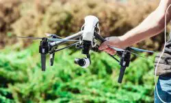
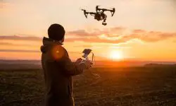
Drones have a wide variety of uses especially in the field of forestry. Researchers have found out that using drones in different applications of forestry is not only cost effective but also not very labor intensive. There are several uses of drones in the field of forestry as has been outlined below.
1. Forest mapping and biodiversity
Drones can be used in forest mapping and this has already paid off in places such as Indonesia. A small drone was deployed to fly over a forested area and this was able to return data that showed the vastness of the forest and other relevant information including human activities around the forest.
2. Precision forestry and forestry management
Different parameters relating to forests such as the extent of canopy cover, the number of trees and volume estimation can also be achieved efficiently through the use of unmanned aircrafts. This data collected by use of drones are usually accurate and can help in quick and better decision making as opposed to other methods.
3. Mapping canopy gaps
Forest disturbances are mostly caused by wind and snow and these have a direct impact on the productivity of forest stands. This also affects regeneration. Satellite imagery was initially used to access this kind of data by mapping the canopy gaps but the information was not as accurate as it needed to be. This however changed with the introduction of drone remote sensing.
4. Measuring forest canopy gaps and other important attributes
Canopy heights and other canopy attributes are some of the best features of forest used by forest professionals. This data needs to be accessed accurately and thanks to LiDAR technology that can now be mounted on drones, the information can be accessed fast and efficiently.
5. Capturing forest data
Drones can now be used to capture vital forest data such as the depth of snow in the forest, the canopy attributes such as canopy gaps and the extent of carbon storage within a forest. This information is not only relevant to forest researchers but also to forest farmers.
6. 3D mapping for carbon storage
In the past, measuring the extent of carbon storage in biomass has been very labor intensive and very expensive. But thanks to the introduction of drone technology, remote sensing can now be used to get 3D mapping of carbon storage within forests.
7. Restoration of scorched land
Wild fires often cause extensive damage to land and soil after the fire has been extinguished. The process of land restoration is what takes years as it requires extensive land survey and tree planting that could take years. Drones can be used to do these surveys fast and reduce the cost and time of land restoration.
8. Tree planting with drones
Planting trees in a forested area is not an easy task. The land is often not evenly distributed and it is sometimes inaccessible. Drones can be used to distribute seedlings in these areas in a fast and efficient manner and ensure trees are planted.
9. Saving rainforests
Drones are now being used to do aerial surveys of rainforests to determine where the trees have been affected by human activities and the patterns being used to achieve this. Drones can then relay the data to the relevant authorities who use it to make informed decisions.
10. Monitoring illegal quarrying
Drones can be used to monitor illegal quarrying especially in forested areas that cannot be easily accessible by humans. Drones can fly over these areas and take clear shots of the damage that has been caused in these areas and advise authorities on corrective measures to take.
11. Measuring forest stockpiles
Most companies are now using drones to measure stockpiles in the forests. Data on the number of logs, amount of sawdust and woodchips can now be easily determined at a much lower cost than it was before.
12. For dropping fertilizer
One of the toughest and labor intensive jobs is the sprinkling of manure and fertilizer in forested areas. Drones have come in handy in helping to spread fertilizer over forested areas that were previously inaccessible.
13. Combating deforestation
Communities and companies are now using drones to fight deforestation. Apart from just using drones to plant the trees, these UAVs are now being used to keep an eye on the forests to capture people or activities that undermine the existence of the forests.
14. For forest research
Some companies interested in forest research have employed the use of drones because they are cheap and save a lot of time. They can easily collect data related to the forests including the extent of the forest cover, forest attributes and so on.
15. Forest security
A lot of forest cover is being lost to unscrupulous business people through logging and this ends up causing global warming. Law enforcement authorities have also employed the use of drones to do forest cover monitoring to arrest the people who are destroying them.
Amazon and the Amazon logo are trademarks of Amazon.com, Inc, or its affiliates.